


Copper Canyon and the El Chepe Train
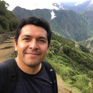
Copper Canyon (Barrancas del Cobre) is a network of six canyons in northern Mexico's Sierra Tarahumara, together covering roughly 25,000 square miles — about four times the Grand Canyon's footprint, with the deepest sub-canyon (Urique) actually surpassing the Grand Canyon's maximum depth. The classic way to see it is the El Chepe train between Los Mochis or El Fuerte and Chihuahua, with a stop at the Divisadero viewpoint. Give it 4-6 days; tourist-class Chepe Express tickets run roughly $135 one-way.
Most people have never heard of Copper Canyon, and that's honestly the appeal — it's a genuinely different Mexico from the beach resorts and colonial cities: a rugged, remote canyon system home to the Raramuri (Tarahumara) people, crossed by a train line that took nearly a century to finish and is still considered one of the great railway engineering feats in the Americas.
How many days do you need?
Four to six days minimum: the train ride itself, at least one night in Creel or Divisadero to actually see the canyon (not just pass through it), and ideally a night in El Fuerte, the charming colonial town at one end of the route, rather than treating either endpoint as a pure transit stop.

Is Copper Canyon really bigger than the Grand Canyon?
Yes, in the ways that matter most for the comparison. Copper Canyon isn't a single canyon but a system of six major canyons covering roughly 25,000 square miles, against the Grand Canyon's roughly 1,900 square miles — about four times larger as a network. At its deepest point (the Urique sub-canyon, around 6,164 feet), it also slightly exceeds the Grand Canyon's maximum depth of about 6,093 feet. It's simply far less visited and far less developed for tourism, which is part of why it stays under most travelers' radar.
The El Chepe train
| Class | One-way price | Notes |
|---|---|---|
| Chepe Express (tourist class) | ~$135 | Creel–Los Mochis segment |
| Chepe Express (business class) | ~$255 | Meals included |
| Chepe Regional (economy) | $20–30 full route | The full Los Mochis–Chihuahua line, segments from $2.50–10 |
The full Los Mochis-to-Chihuahua route runs about 16 hours end to end, crossing 86 tunnels and 37 bridges over roughly 350 miles (560km) of genuinely dramatic mountain and canyon scenery — most travelers ride a shorter segment (commonly Los Mochis or El Fuerte to Creel, about 9 hours) rather than the full line in one sitting.
Divisadero — the viewpoint and zipline park
The train stops for about 15 minutes at Divisadero, just long enough for the classic canyon-rim photo, but staying longer is worth it: Parque de Aventura Barrancas del Cobre runs a cable car (300 MXN), a 7-line zipline circuit (1,000 MXN), the longest single Ziprider line in the park (1,250 MXN), and a via ferrata climbing route (600 MXN) — book online ahead to skip lines in high season.
Creel and the Raramuri culture
- Creel — the main gateway town for exploring the canyon on the ground, with tour operators for waterfall hikes, hot springs, and visits to Raramuri mission villages.
- The Raramuri (Tarahumara) people — an indigenous group renowned for long-distance running, still living traditionally in and around the canyon; respectful, guide-led visits to their communities are the right way to engage, not unaccompanied wandering.
- El Fuerte — a genuinely lovely colonial town at the western end of the line, worth a night rather than just a train-station pass-through.
A balanced note on safety
Chihuahua state carries a more nuanced advisory picture than most of Mexico's tourist regions — some areas (particularly Ciudad Juarez and certain border-adjacent highways) are rated at a higher advisory level, largely tied to trafficking routes, not the tourist circuit. The established Copper Canyon route — Chihuahua City to Creel to Divisadero to El Fuerte via the official Chepe train — has operated for decades with a strong safety record and regular international visitor traffic. The practical takeaway: stick to the standard rail route and established tour operators, and check your government's current state-level guidance for Chihuahua specifically before planning any detour off that circuit.
When to go
October through April is the shoulder/dry season and generally the best window, but the climate varies enormously by elevation — Creel and Divisadero sit around 7,500 feet (2,300m) and can see near-freezing temperatures and occasional snow in December-February, while the canyon floor towns like Batopilas stay warm to hot year-round. Spring and fall tend to be the most comfortable compromise across both elevations.
Getting there
The train's two endpoints are Los Mochis (Sinaloa, near the coastal Los Mochis airport) or El Fuerte on one side, and Chihuahua (with its own airport, CUU) on the other. Most travelers fly into one end via a connection through Mexico City, Guadalajara, or Hermosillo, ride the train through the canyon, and fly out the other end rather than backtracking.